Support for Drupal 7 is ending on 5 January 2025—it’s time to migrate to Drupal 10! Learn about the many benefits of Drupal 10 and find migration tools in our resource center.
This tutorial will guide you through the initial steps to get up and running with Cartaro. Because Cartaro is based on several open source components, we need to make sure all requirements are met. This guide is based on Ubuntu Precise (12.04 LTS). You might need to adapt commands depending on your Linux distribution.
If you find the installation too complicated for a first sight at Cartaro then you should try Cartaro on the OSGeo Live DVD or use the Docker container for Cartaro.
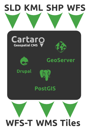
The tight integration of Cartaro with GeoServer allows you to publish your geospatial data in a multitude of data formats and web services. As soon as content types with geospatial data fields have been created, you will be able to add layers to your GeoServer through Cartaro. Creating your own GeoServer styles (SLD format) allows for visual customization of GeoServer layers.