This is the documentation for the Geofile module
Overview and Features
This module allows you to display files such as KML or GPX on a slippy map.
It's using the excellent Openlayers module to display those data on maps.
This module provides:
- A formatter for file field: Geofile Map
- A view style to display results on a map using the submodule Geofile Views
- An hybrid layer for Openlayers: allows you to store features from layers into a single layer.
Related modules
Installation
Requirements
- Openlayers 2.x
- GeoPHP
- Views: Optional, only for Geofile Views
Needs an explanation here
Usage
Formatter for a file field
Add a field of the file type
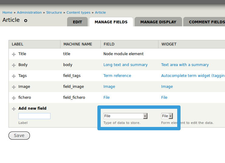
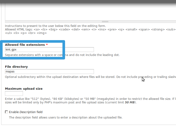
Don't forget to put the file type (KML/GPX) that you need in the allowed extension options
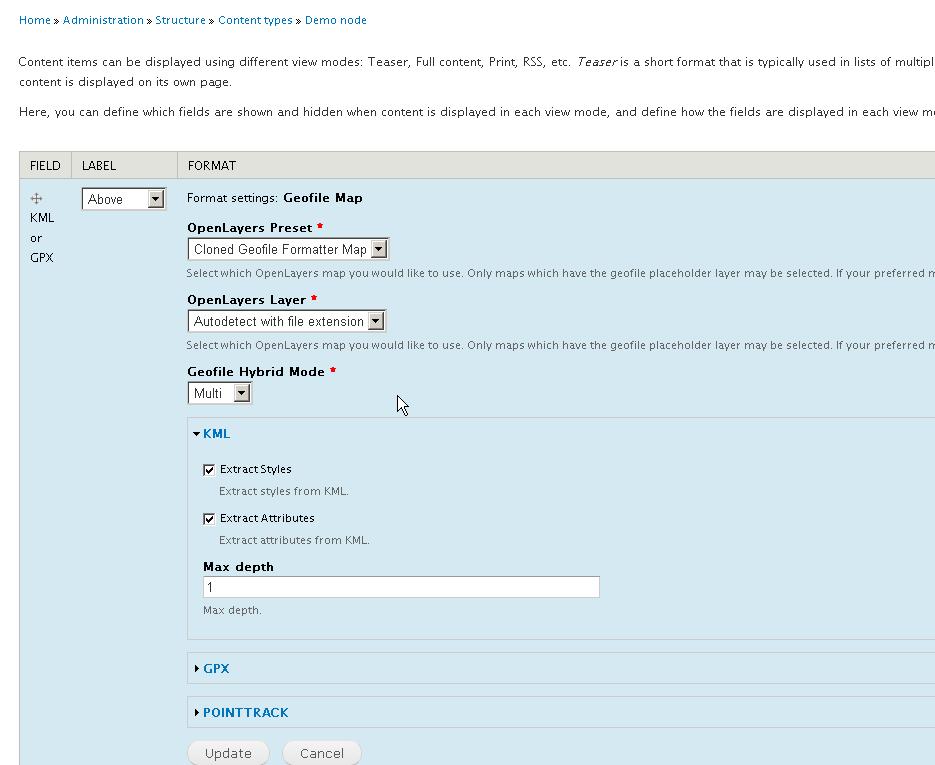
Choose the display option for your field
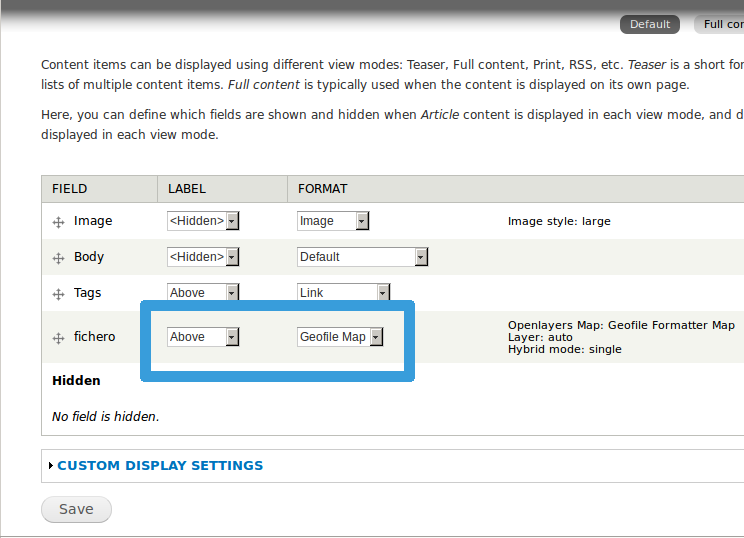
Personalize your options
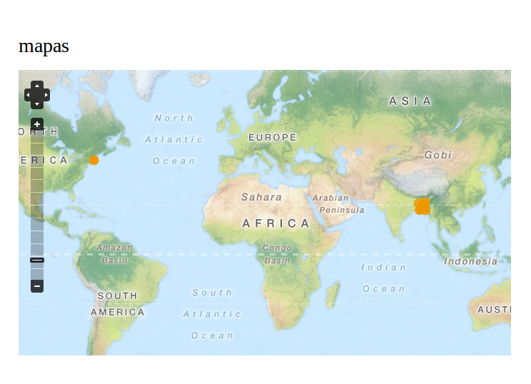
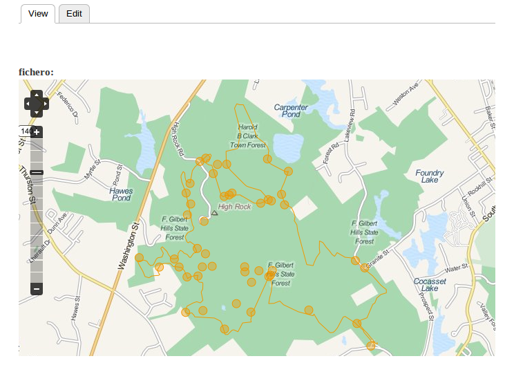
Create a new node uploading your data and see the results
GeoFile Views
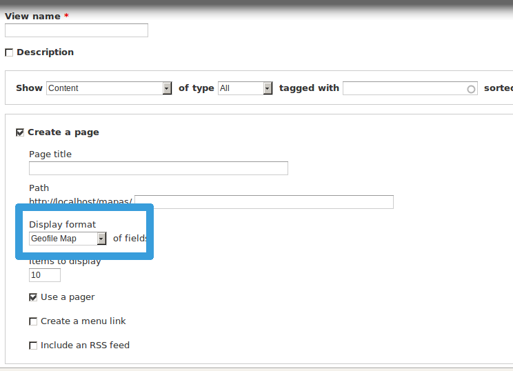
Create a new view, select the Geofile Map display format and save
Add your fields
You do not have to edit the formatter of the file field containing the KML or GPX files
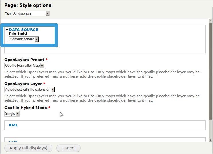
Choose the file field as data source in the settings
Save the view and go to the path that you configured. You will see all your nodes in one map