
 Come together with the global Drupal community in Rotterdam, 28 Sept – 1 Oct 2026. Sessions, contribution, connection, and Early Bird savings until 8 June.

Drupal advanced integration with the
Leaflet JS mapping library.
A Modern, Lightweight Open-Source JavaScript Library for Interactive Web Mapping
Drupal Leaflet module is dependant from the
Geofield module.
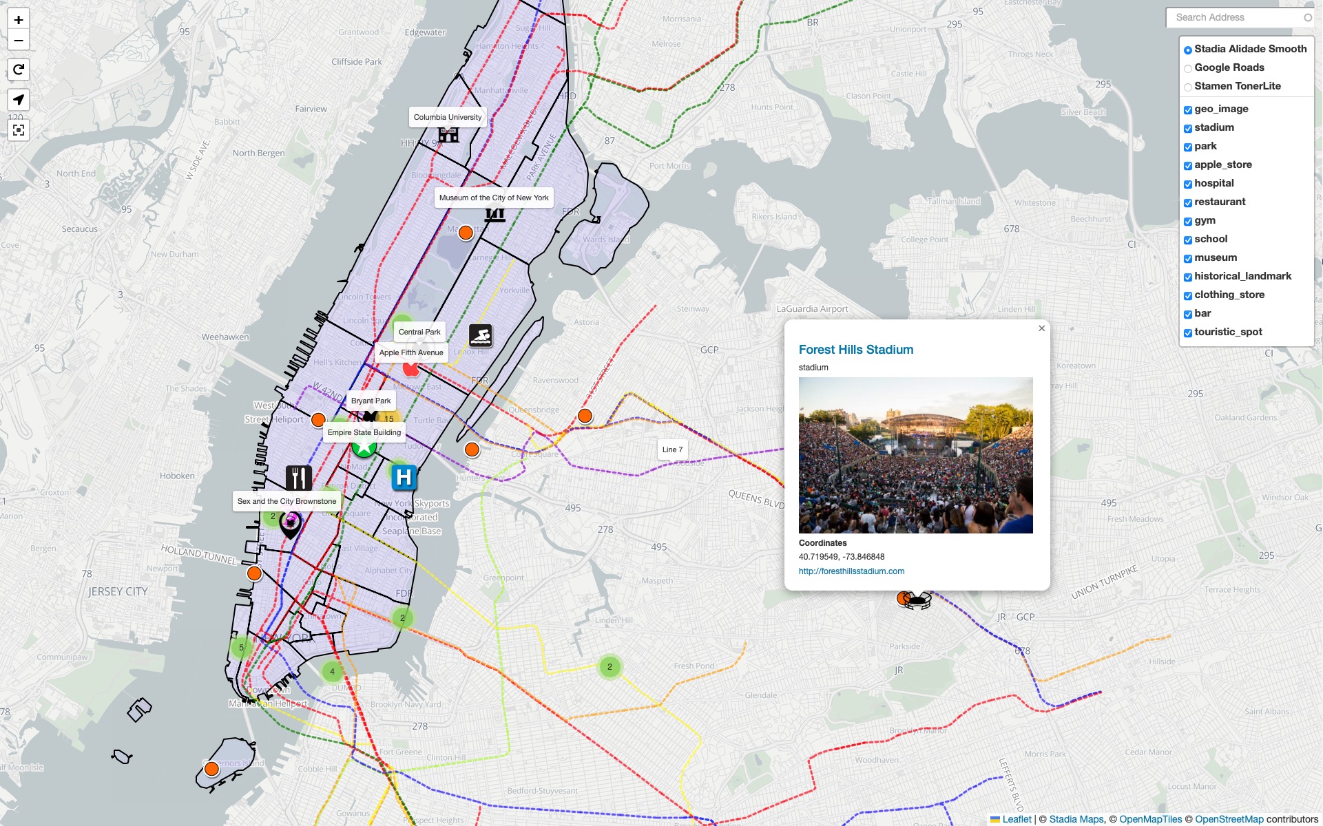
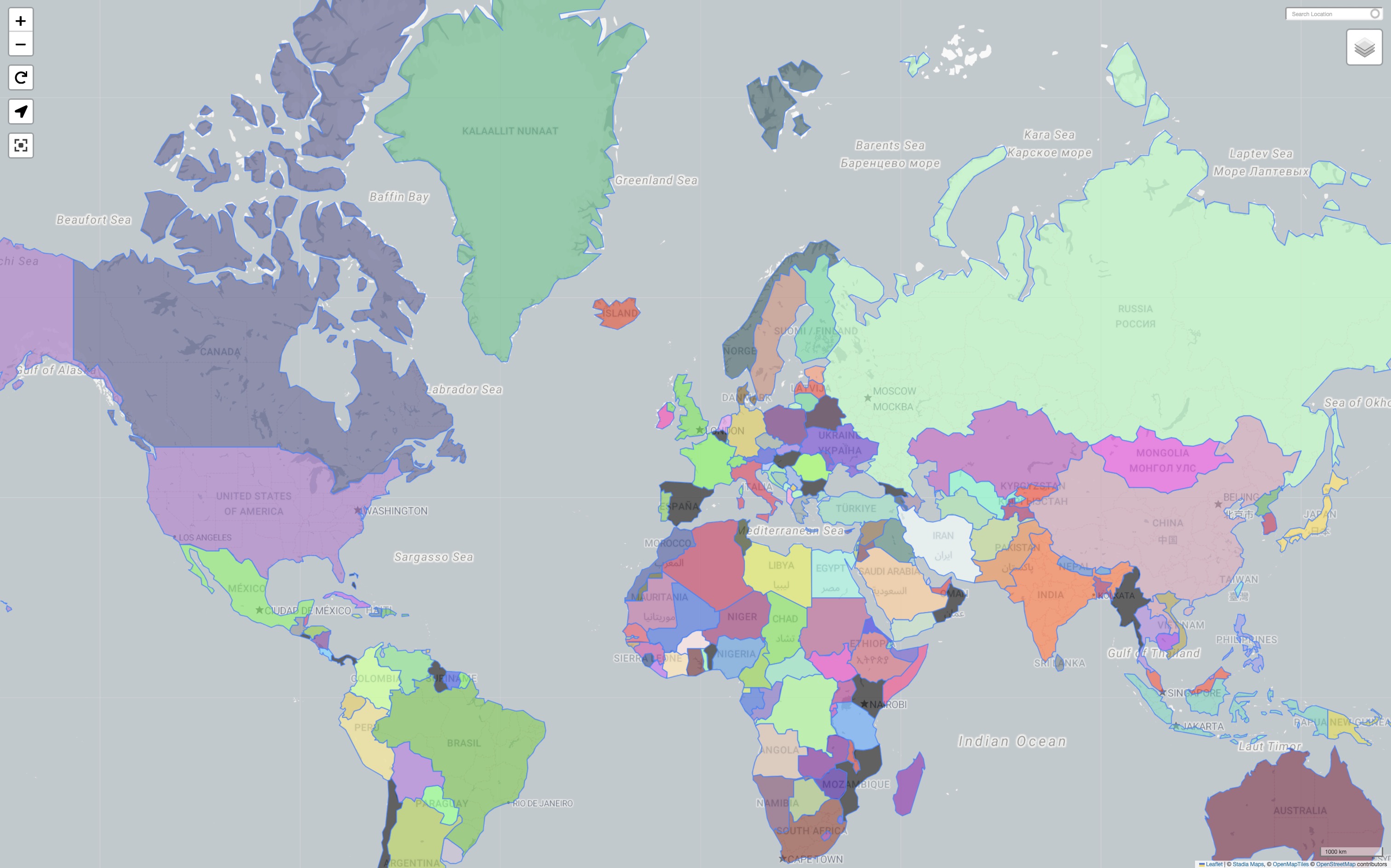
> 👉 LIVE DEMO <
MOST RELEVANT LATEST NEWS
- July 2025: 🚀 The release of the new Leaflet Choropleth module finally brings professional-grade Choropleth thematic mapping to the Drupal Geofield & Leaflet ecosystem!
Refer to #3536863 Leaflet project issue for more info. - June 2025: Leaflet 10.3.x and 10.3.0 release now supports GeoJSON Overlays in Leaflet Widget Maps.
Refer to #3505326 Leaflet project issue for more info. - February 2025: Leaflet 10.0.37 adds Option to Leaflet Widget for Placing Markers on the Map via Geocoding.
Refer to #3505326 Leaflet project issue for more info.
Leaflet Version 10+
Drupal Community documentation (WIP)
Featured options and functionalities
- Easy-to-use programmatic API via
LeafletServicefor extended Leaflet map definition, rendering, and customisation; - Field formatter (
LeafletDefaultFormatter) for read-only map display from any Geofield value; - Field widget (
LeafletDefaultWidget) with Leaflet-Geoman
integration for creating and editing Points and Geometries (LineString, Polygon); - GeoJSON overlays (external and internal sources) on the widget map as visual
snapping references for precise drawing; - Popups and Tooltips on map features, with AJAX lazy-load support for popup content;
- Multi-layer base map control and overlay layers control via Drupal Views grouping;
- Vector tile rendering via MapLibre GL JS tile layer support;
- Dynamic marker icons and path/geometry styling with Token and replacement-pattern support;
- Marker clustering via Leaflet.markercluster (bundled as
leaflet_markerclustersubmodule); - Views integration via the
leaflet_viewssubmodule: Views style plugin, row plugin, and an Attachment display for overlaying markers from one view onto another view's map; - Bundled map controls: gesture handling (GestureHandling),
reset view (ResetView),
fullscreen (FullScreen),
and user location (Locate); - Feature additional properties for advanced and dynamic customisation of map
and feature rendering logic; - Address search geocoding with autocomplete (requires Geocoder module);
- Multiple Leaflet maps (formatters, Views, and widgets) on the same page;
- Drupal hooks (
hook_leaflet_map_info(),hook_leaflet_map_info_alter()) for defining and altering map definitions, features, and rendering; - JavaScript events (
leafletMapInit,leaflet.feature,leaflet.features) dispatched on the map container for frontend integration and customisation.
Installation and Use
Require/Download the Leaflet module using Composer, which is simply running
the following command from your project package root (where the main
composer.json file is sited):
composer require drupal/leaflet
which will also download the required Geofield Module
dependency (and GeoPHP library).
Read the instructions in the Readme.md file for further details, on how to
enable the Leaflet module and its submodules.
Additional Drupal Integrations
Leaflet module works well with the following modules;
- Leaflet Choropleth
- Leaflet More Maps
- Leaflet More Markers
- Leaflet Layers
- Views GeoJSON
- Leaflet GeoJSON
- Geocoder
- Geofield Map
D8 version started by RdeBoer of flink, and evolved to maturity by Itamair.
Leaflet Version 7
The Leaflet module features:
- Field formatter that can show a map for fields that contain geospatial data.
- Views integration that plots data on a map (using the sub module Leaflet Views).
- Lightweight and easy to use API for defining maps and displaying data on a map.
Some modules that build on Leaflet, adding various features:
- Leaflet More Maps: adds over 20 map styles, selected at the flick of a drop-down
- Leaflet Label: alternative tool tip hovers for polygons and line strings
- Leaflet Hash: bookmarking for maps, appends a hash of current map center and zoom to the URL, so you save and restore the "view port"
- Leaflet MarkerCluster: makes large marker populations easier to navigate through animated clustering and drill-down capability
- IP Geolocation Views & Maps: adds a swag of cool features such as centering options, markers colour-coded by any field in your View, cross-highlighting between content and map, geocoding and reverse geocoding options.
- Many more...
Drupal Leaflet Showcase
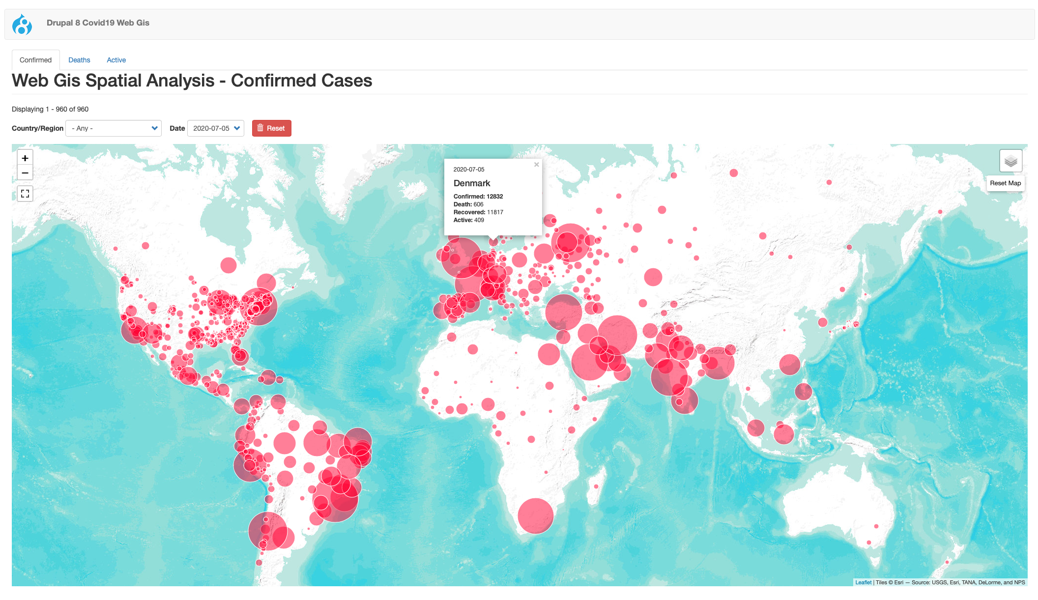
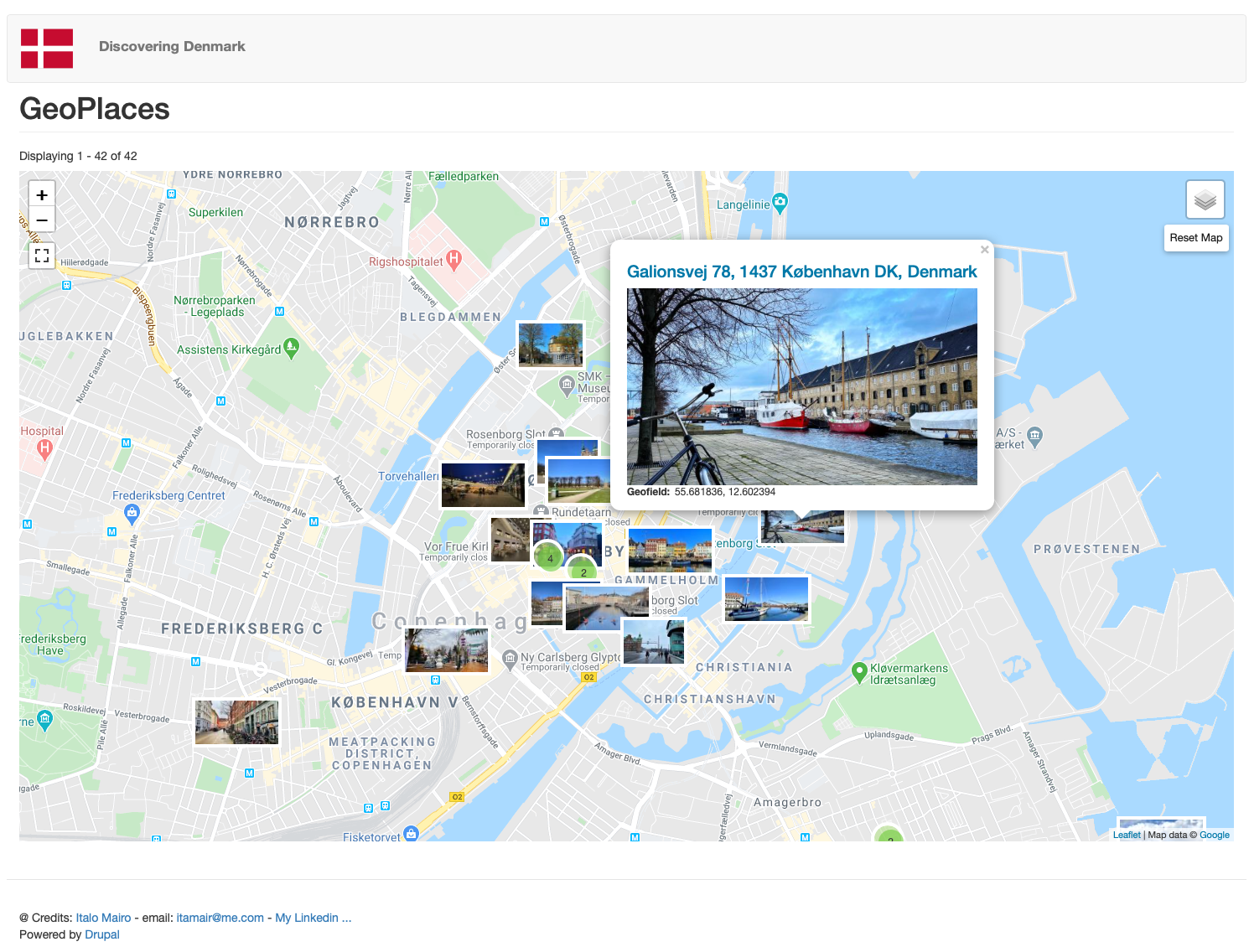
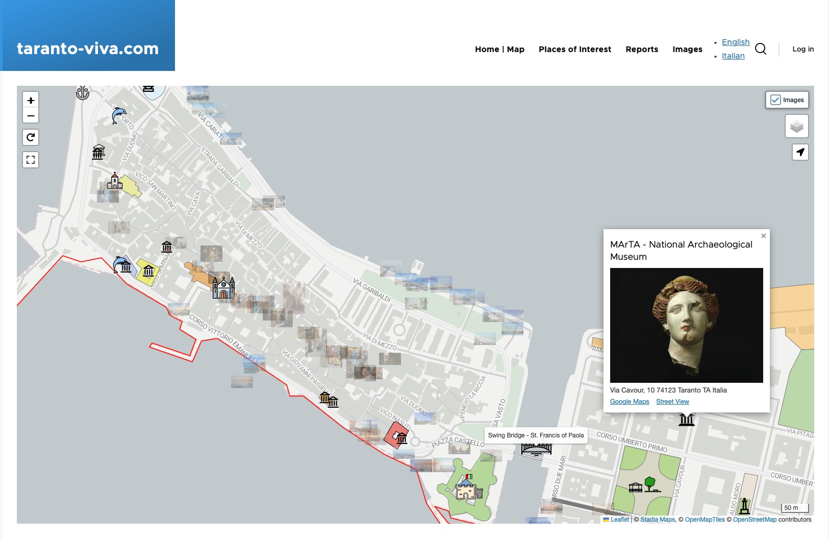
Some Cool Websites using Drupal Leaflet
- https://arst.dk/kort
- https://www.wastereduction.gov.hk/en-hk/recycling-map
- https://www.taranto-viva.com
- https://www.geodemocracy.com/via-degli-dei-2024/web/
- https://www.geodemocracy.com/copenhagen-discovery/web/
- https://librarybuildings.info/map
- and k others ...
D7 version originally developed by ThinkShout and @pvhee (from Marzee Labs) with lots of help from the community.
Project information
- Project categories: Content display, Integrations, Site structure
- Ecosystem: Geofield
 32,730 sites report using this module
- Created by levelos on , updated
 Stable releases for this project are covered by the security advisory policy.
Look for the shield icon below.
Releases
10.4.9
released 22 May 2026
Works with Drupal: ^10.3 || ^11
Most stable and documented release
Install:
Development version: 10.4.x-dev updated 22 May 2026 at 22:09 UTC
10.3.12
released 10 January 2026
Works with Drupal: ^9.3 || ^10 || ^11
Not further maintenance (will be unsupported soon ...)
Install:
Development version: 10.3.x-dev updated 10 Jan 2026 at 14:18 UTC


